

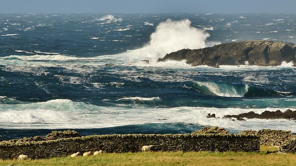
 Image source, BBC Weather Watchers / Beenister
BBC Weather Watcher Beenister captured a dramatic scene in Sumburgh in the Shetland Islands
-
Published2 hours ago
Storm Lilian – the 12th named storm of the season – will be bringing gales and heavy rain to parts of the UK on Friday.
Yellow weather warnings for wind and rain have been issued by the Met Office as there may disruption to travel, potential for trees to come down or for damage to buildings.
Conditions are then expected to quieten down for the bank holiday weekend.
Storm Lilian
The storm will bring an area of strong winds across northern England with gusts widely 50 to 60mph.
There's even a chance of some intense winds gusting up to 80mph and a Met Office yellow warning for wind has been issued for 05:00 BST to 11:00 BST on Friday.
It specifically mentions possible problems for drivers on the M6, A66 and A1(M).
Heavy rain will also spread eastwards with the potential for some localised flooding.
There are two separate yellow weather warnings for rain in south-west Scotland and eastern Scotland overnight into Friday.
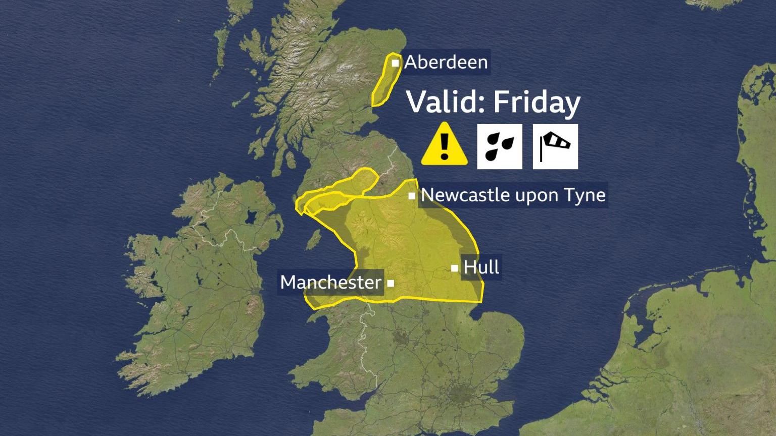 Image source, BBC Weather
Storm Lilian will bring impacts to northern England and parts of Scotland with heavy rain and strongs winds on Friday
Summer storms
Named storms in August don't happen that often.
Since we started naming storms in 2015/2016 there have only been two years when we've had named storms.
Last year we had storms Antoni and Betty bring some disruption.
Before that, in 2020 there were Ellen and Francis.
Spells of wetter and windier weather however, aren't too uncommon for late August.
While some are still on summer holidays we are racing ever closer to autumn which meteorologically starts on 1 September.
At this time of year the jet stream – fast winds high in the atmosphere – can pick up speed and direct Atlantic weather systems towards the UK.
Getting close to the peak of the hurricane season also can bring the potential for ex-hurricanes to get caught up in the jet stream.
On Wednesday night the remnants of ex-hurricane Ernesto brought strong winds and heavy rain to parts of the UK.
Lilian is the 12th named storm this season and this is the first time we've reached the letter 'L' since we started naming storms.
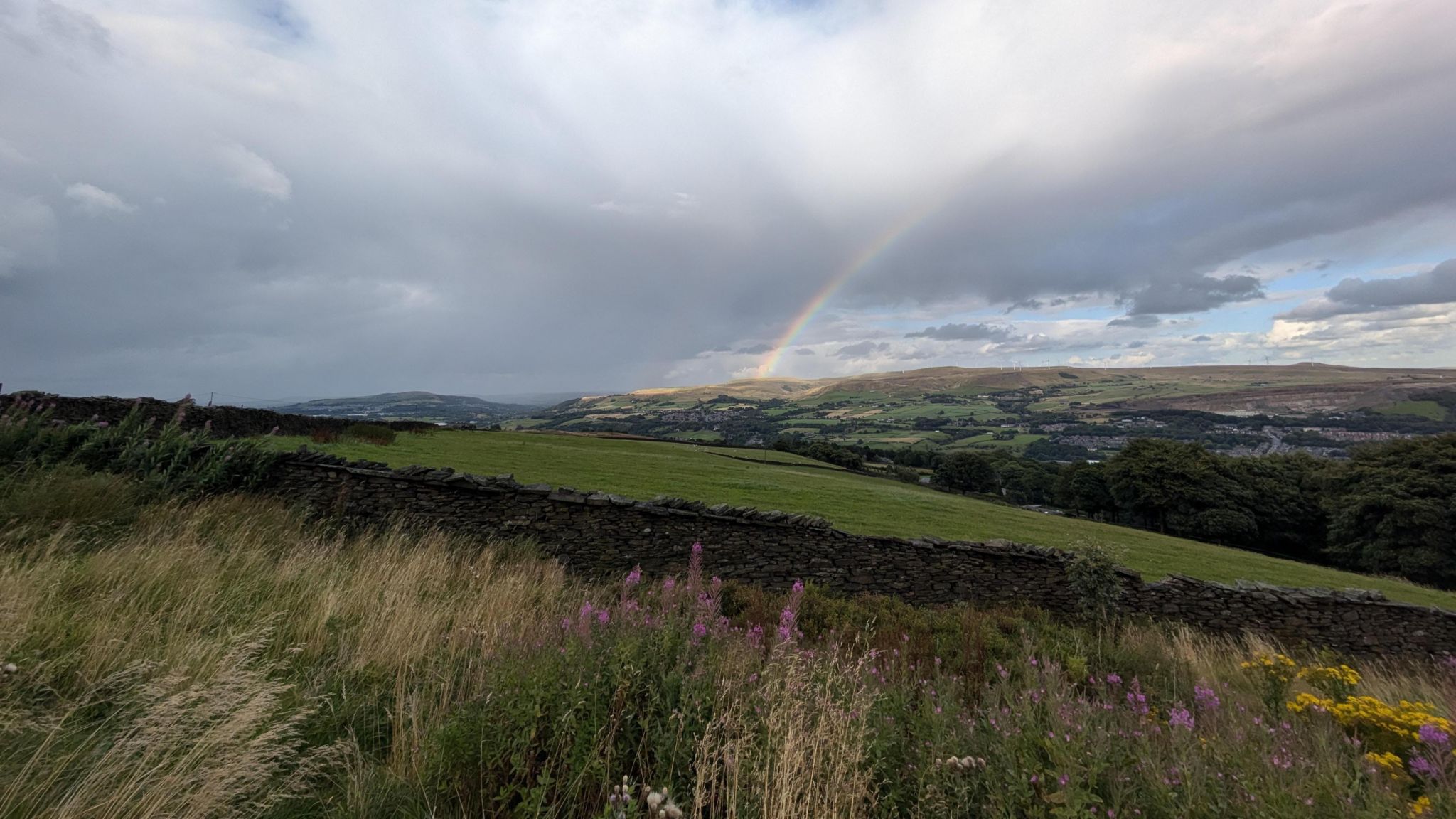
 Image source, BBC Weather Watchers / DaveE
The bank holiday will be a little mixed with some spells of rain but overall dry with some sunshine
Bank holiday weather
After Storm Lilian passes there are some improvements in the weather for the bank holiday weekend.
There will still be some spells of rain and showers at times but over the course of the whole weekend there will be a lot of dry weather with some sunshine.
Temperatures are likely to remain just below average for the time of year and it'll still be quite blustery at times.
-
-
Published19 hours ago
-